Key Takeaways
- New metro lines in Mumbai, Bengaluru, and Chennai are set to significantly alter monsoon commute experiences starting late 2026.
- Expect reduced travel times and enhanced reliability, especially on previously waterlogged routes, though initial phases might see teething issues.
- Integrated ticketing and real-time information systems are crucial for seamless transfers and managing crowd flow during heavy rainfall.
- While fare structures aim for affordability, understanding the new network’s coverage will be key to maximizing cost savings and convenience.
Mumbai’s Coastal Connectivity Boost: Battling the Bains in 2026
Mumbai, a city synonymous with its monsoon deluge, is poised for a significant shift in its urban transport landscape with the imminent commissioning of several new metro lines. By late 2026, commuters in the western suburbs and along the eastern coast can anticipate a more predictable and comfortable journey, even as the heavens open up. The much-anticipated Line 10 (Gai-T M-Navi Mumbai Metro) and extensions to the existing Line 7 (Dahisar East-Andheri East) and Line 8 (Bandra-Kutai) are slated for partial or full operationalization. These new arteries promise to siphon off a substantial portion of the traffic that currently chokes the roads, often turning crucial commutes into waterlogged ordeals. For instance, areas like Kandivali and Borivali, which have historically struggled with monsoon-induced connectivity issues, will now have a direct, elevated link to key business districts.
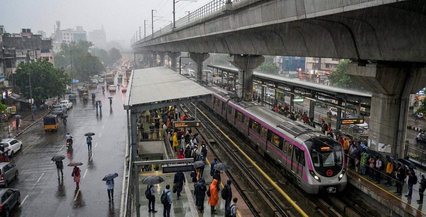
The focus isn’t just on speed; it’s on reliability. Traditional road transport in Mumbai is notoriously vulnerable to waterlogging, especially in low-lying areas like Sion and Kurla. The elevated nature of the new metro lines offers a significant advantage, keeping commuters above the rising water levels. This means fewer cancellations and delays, a stark contrast to the unpredictable chaos of past monsoons. Furthermore, the integrated design of these new lines, often connecting seamlessly with existing suburban railway stations, aims to create a more cohesive public transport network. This is crucial for last-mile connectivity, ensuring that even if the metro doesn’t drop you at your doorstep, reaching your destination becomes a far less arduous task. Imagine stepping off a sweltering local train and seamlessly boarding an air-conditioned metro carriage, bypassing street-level gridlock entirely. This is the promise of Mumbai’s 2026 monsoon.
The Promise of Elevated Commutes
The strategic placement of these new lines aims to alleviate pressure on the already overburdened Western and Central suburban railway lines, particularly during peak monsoon months. By offering a viable alternative, the metro system is expected to decongest not only roads but also train platforms, a welcome respite for millions of Mumbaikars. The integration with existing infrastructure is key; stations are designed with elevated walkways connecting directly to railway stations and bus depots. This multi-modal approach is vital for ensuring that the benefits of the metro extend beyond immediate station vicinity.
Surprising Fact: Integrated Water Management
Did you know that several new metro stations in Mumbai are being equipped with advanced rainwater harvesting and drainage systems? These aren’t just for the metro tracks themselves but are designed to help manage local water accumulation around station areas. The aim is to mitigate the ‘urban flooding’ effect that often plagues these densely populated zones, turning a potential inconvenience into a small-scale community benefit. This forward-thinking approach is a significant departure from previous infrastructure projects.
Bengaluru’s Tech Corridor Transformation: Flowing Freely in the Rains
Bengaluru, India’s Silicon Valley, has long grappled with traffic congestion that intensifies dramatically during the monsoon season. Pothole-ridden roads and flooded underpasses are not just inconveniences; they are significant impediments to productivity and daily life for its millions of residents. The recent commissioning of new phases of the Namma Metro’s Pink Line (Kalena Agrahara to Bannerghatta Road) and the Yellow Line (RV Road to Bommasandra), slated for late 2026 completion, promises to be a game-changer for the city’s southern and eastern corridors. These lines are strategically routed through some of the city’s most congested IT hubs and residential areas.
For tech professionals commuting between areas like Electronic City, Marathahalli, and Indiranagar, the new metro lines offer a lifeline. Previously, a journey that should take 45 minutes could easily stretch to two or even three hours during heavy downpours. The elevated sections of these new lines will provide a secure and predictable commute, unaffected by the usual street-level chaos. This means fewer missed meetings, more reliable work schedules, and a significant reduction in the daily stress associated with navigating Bengaluru’s monsoon-ravaged roads. The Yellow Line, in particular, connects key industrial and IT parks, directly impacting the daily transit of thousands.
Connecting the Tech Hubs
The Yellow Line’s route is particularly significant. It directly links the bustling RV Road to the sprawling industrial and IT areas around Bommasandra, passing through crucial commercial zones. This will provide a much-needed alternative for commuters who currently rely on often unreliable bus services or face the perpetual struggle of navigating congested arterial roads. The Pink Line’s extensions further bolster connectivity, reaching deeper into residential areas and ensuring a more comprehensive network coverage. This integrated approach is vital for encouraging modal shift from private vehicles to public transport.
The Impact on Last-Mile Connectivity
Beyond the main corridors, the success of these new lines hinges on effective last-mile connectivity. Bengaluru Metro Rail Corporation Limited (BMRCL) is actively working with app-based ride-sharing services and introducing feeder bus routes to ensure seamless transitions from metro stations to final destinations. This focus on integrated transit solutions is crucial for maximizing ridership and ensuring that the metro’s benefits reach as far as possible, even into areas less directly served by the main lines. The aim is to make the entire journey, from doorstep to destination, as smooth as possible, rain or shine.
Chennai’s Metro Expansion: Navigating the North-East Monsoon with Ease
Chennai, a city known for its resilience and vibrant culture, has also faced its share of monsoon-related disruptions. The devastating floods of 2015 and subsequent heavy rains have highlighted the critical need for robust urban infrastructure that can withstand extreme weather. The commissioning of the Chennai Metro’s Corridor 4 (Light House to Poonamallee) and extensions to Corridor 3 (Madhavaram to Sholinganallur), expected to be operational by late 2026, will significantly enhance the city’s preparedness and commuter experience during the crucial North-East monsoon season. These new lines are set to connect key commercial hubs, residential areas, and historical districts.
The Lighthouse to Poonamallee stretch, in particular, is a major development. It will link the historic heart of Chennai with rapidly developing suburban areas, offering a reliable transit option for thousands. Previously, commuters travelling between these regions often faced severe delays due to waterlogging on arterial roads like Arcot Road and Jawaharlal Nehru Road. The elevated metro will bypass these challenges entirely, ensuring that journeys are not dictated by the whims of the weather. This brings a new level of predictability to daily commutes, a welcome change for those who have experienced the frustration of being stranded.
Bridging Historical and Modern Chennai
Corridor 4’s route is designed to be a cultural and economic artery. It connects the iconic Lighthouse on Marina Beach to the burgeoning IT and educational institutions in Poonamallee. This blend of historical significance and modern development means the metro will serve a diverse range of commuters, from tourists to daily workers. The integration with existing bus routes and suburban railway stations is being prioritized to create a seamless travel experience. This holistic approach is key to encouraging widespread adoption and making public transport the preferred choice.
Surprising Fact: Flood Resilience Engineering
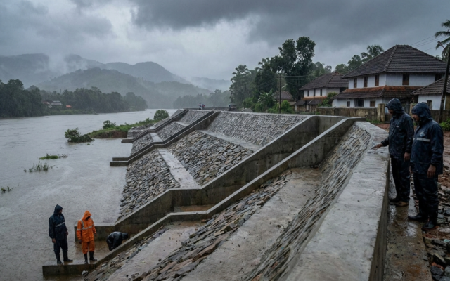
Chennai Metro’s new lines incorporate advanced flood resilience engineering. This includes elevated track structures, specially designed drainage systems for stations and tunnels, and backup power systems designed to operate even during prolonged power outages caused by monsoons. The design specifications often exceed standard international guidelines for flood-prone urban areas. This meticulous planning aims to ensure that the metro system remains operational and safe, even in the face of severe weather events that have previously crippled the city’s transport network.
The Integrated Ticketing Conundrum: Seamless Journeys in 2026
As new metro lines roll out across India’s major cities in 2026, a critical factor for commuter satisfaction, especially during the monsoon, will be the integration of ticketing systems. Simply having new lines isn’t enough; the ability to move seamlessly between different metro lines, and crucially, between metro, local trains, and buses, will determine the true effectiveness of these infrastructure upgrades. The goal is to create a single, unified travel experience, akin to London’s Oyster card or Singapore’s EZ-Link. For commuters caught in sudden downpours, the ability to tap a single card or app to pay for their entire journey, regardless of the mode of transport, will be invaluable.
Currently, many cities have fragmented ticketing. While some metros offer smart cards, their acceptance on other transit modes is limited. The push towards National Common Mobility Card (NCMC) compliant systems is gaining momentum, and by late 2026, we can expect to see wider adoption. This will allow commuters to use a single card for metro, buses, and even local trains in some corridors. Real-time passenger information systems, displayed on digital screens at stations and via mobile apps, will also be crucial. Knowing exactly when the next train or bus is arriving, and whether there are any delays due to weather, can significantly reduce anxiety and allow for better planning.
The Promise of Unified Payments
Imagine a scenario: you’re commuting to your office in Bengaluru, and it starts raining heavily. Instead of fumbling for different tickets or worrying about cash for multiple modes, you simply tap your NCMC card on the metro gate, then on the feeder bus, and finally on the local train ticket barrier. This is the future that integrated ticketing aims to deliver. It not only enhances convenience but also speeds up boarding times, which is critical when everyone is trying to get out of the rain. The reduction in manual transactions also minimizes potential delays.
The Role of Mobile Apps
Beyond physical cards, mobile applications are playing an increasingly vital role. By 2026, expect these apps to offer not just journey planning and real-time tracking but also integrated ticketing and payment options. Users will be able to purchase journey passes, top up their cards, and even book last-mile transport like ride-sharing services directly through these platforms. This digital integration is key to making public transport more accessible and user-friendly, especially for younger, tech-savvy commuters who are accustomed to managing their lives through their smartphones.
| Feature | Current Scenario (Late 2025) | Projected Scenario (Late 2026) | Impact on Monsoon Commutes |
|---|---|---|---|
| Single Ticketing System (Metro-Metro) | Limited integration in some cities (e.g., Mumbai, Delhi) | Widespread adoption of NCMC across major metro networks | Faster, seamless transfers between different metro lines, reducing exposure to rain. |
| Inter-modal Ticketing (Metro, Bus, Train) | Fragmented; often requires separate tickets/cards | Significant progress towards NCMC acceptance on buses and suburban trains in key cities | Holistic journey planning and payment, reducing stress and travel time during downpours. |
| Real-time Information Systems | Variable; some apps offer live updates, others are basic | Enhanced app functionality and station displays with predictive analytics for delays | Better informed decisions on travel routes and timings, minimizing waiting in rain. |
| Contactless Payment Options | Growing; tap-to-pay on cards and some mobile wallets | Standard feature on most metro systems, expanding to feeder services | Quicker entry and exit at stations, essential for avoiding prolonged exposure to heavy rain. |
Fare Structures and Affordability: Value for Money in 2026 Monsoons
As India invests heavily in expanding its metro networks, a crucial aspect for commuters is the affordability and transparency of fare structures. The goal for these new lines, rolling out in late 2026, is to offer a cost-effective alternative to private vehicle usage, especially during the monsoon when fuel costs and parking can escalate. While metro fares are generally higher than bus or local train fares, the time saved and the reliability offered during heavy rainfall often justify the premium. Cities like Mumbai, Bengaluru, and Chennai are implementing tiered fare systems, often based on distance traveled.
The new lines are generally designed with commuter affordability in mind, but understanding the fare policy is key. For instance, many metro corporations offer concessional passes for regular commuters, such as monthly or quarterly passes, which can significantly reduce the per-trip cost. These passes become particularly attractive during the monsoon when daily commutes become more predictable and thus, more suitable for long-term planning. Furthermore, the introduction of integrated ticketing systems, as discussed earlier, often comes with fare benefits for multi-modal journeys, encouraging a shift away from single-mode, often car-based, travel.
Navigating the Pricing Tiers
Understanding how fares are calculated is essential. Most metro systems use a distance-based fare model. This means shorter journeys are cheaper, and longer journeys incur higher costs. For instance, a short hop within a few stations might cost around ₹10-₹20, while a journey covering the entire length of a new corridor could range from ₹50-₹70. The introduction of new lines, especially those connecting previously underserved areas, aims to make these fares competitive with the combined costs of fuel, parking, and the wear-and-tear of a private vehicle during monsoon conditions. The convenience of avoiding traffic jams and waterlogged roads also adds significant, albeit intangible, value.
Surprising Fact: Peak vs. Off-Peak Pricing
While not yet universal, some Indian metro systems are beginning to experiment with dynamic pricing for peak and off-peak hours, and this trend is expected to grow by 2026. This means fares might be slightly higher during peak monsoon rush hours (e.g., 8-10 AM and 5-7 PM) and lower during off-peak times. The logic is to incentivize travel during less crowded periods, thereby distributing passenger load more evenly and potentially reducing wait times and overcrowding, especially critical during inclement weather. Commuters who can be flexible with their timings might find significant savings.
“The true measure of a successful metro line isn’t just its speed or capacity, but its ability to become an indispensable part of daily life, offering a predictable haven from the chaos, especially when the monsoon hits.”
The Last Mile Challenge: Reaching Your Destination in 2026’s Rain
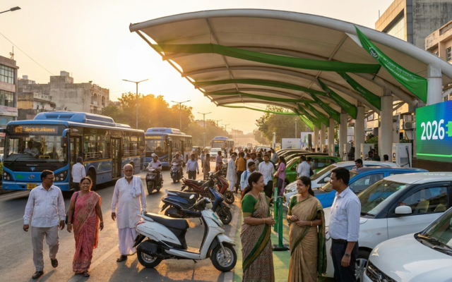
Even with the most advanced metro networks, the last-mile connectivity remains a critical hurdle, particularly during the monsoon. For commuters, the metro station is often just one part of their journey; reaching their home or office from the nearest station can still be a challenge, especially when heavy rains make walking or cycling difficult and roads are congested. By late 2026, we expect to see more integrated solutions being implemented by metro authorities and private operators to bridge this gap. This includes a stronger focus on feeder bus services, ride-sharing partnerships, and even the promotion of electric scooters and cycles.
In cities like Bengaluru and Mumbai, where ride-sharing services are prevalent, partnerships between metro corporations and these platforms are becoming increasingly common. Expect to see dedicated pick-up and drop-off zones at metro stations, integrated payment options within ride-sharing apps for journeys starting or ending at a metro station, and potentially even discounted fares for such “first-mile/last-mile” trips. The aim is to make the entire door-to-door journey as seamless and weather-proof as possible, reducing the reliance on private vehicles. This is particularly important for women, the elderly, and those with mobility issues who may find navigating flooded pavements particularly challenging.
Feeder Services: The Unsung Heroes
The humble feeder bus services are often the unsung heroes of last-mile connectivity. Metro authorities are increasingly recognizing their importance and are expanding their networks. By 2026, expect to see more frequent and reliable feeder bus routes connecting metro stations to residential colonies, commercial complexes, and other public transport hubs that are not directly served by the metro. These buses are often smaller, more agile vehicles designed to navigate narrower streets and potentially congested access roads, making them ideal for monsoon conditions.
The Rise of Micro-Mobility
Electric scooters and shared bicycle schemes are also poised to play a larger role in last-mile connectivity by 2026. While their effectiveness during heavy monsoon downpours might be limited, they offer a viable option for shorter distances and lighter rains. Metro authorities are likely to collaborate with micro-mobility providers to establish designated parking zones near stations, encouraging their use for quick trips to and from the metro. This offers an eco-friendly and often quicker alternative to traditional taxis or auto-rickshaws for short distances.
Frequently Asked Questions
Will the new metro lines be fully operational by the 2026 monsoon?
While significant portions of the new lines in Mumbai, Bengaluru, and Chennai are slated for operationalization by late 2026, it’s common for large infrastructure projects to experience phased rollouts. Some sections might open earlier, with full completion potentially extending into early 2027. We advise checking specific project timelines for the most up-to-date information closer to the season.
How will the new metro fares compare to existing transport options during the monsoon?
Metro fares are generally higher than bus or local train fares. However, when factoring in the time saved, the increased reliability during heavy rains, and the potential costs associated with fuel, parking, and vehicle wear-and-tear for private vehicles, the metro often presents a more cost-effective and less stressful option during the monsoon.
What measures are in place to ensure the metro system remains functional during heavy flooding?
New metro lines are being constructed with advanced flood resilience engineering, including elevated tracks, robust drainage systems, and backup power sources. While no system is entirely immune, these measures are designed to significantly enhance operational continuity during severe weather events.
How can I find real-time information about metro services and potential monsoon-related disruptions?
By 2026, expect enhanced mobile applications and digital displays at stations to provide real-time train schedules, platform information, and immediate updates on any delays or disruptions. Integrated ticketing apps will also be key to planning your entire journey seamlessly.
Will these new metro lines significantly reduce overall city traffic during the monsoon?
Yes, the aim is to divert a substantial volume of commuters from roads to the metro, thereby reducing overall traffic congestion. However, the full impact will depend on widespread adoption and effective integration with other public transport modes for last-mile connectivity.